
Presentation about underwater photogrammetry in Mazotos, @ NAS fieldschool 2016
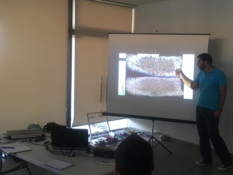
You may download the presentation
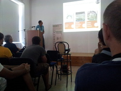
Lecture to students of MSc in "Field archaeology on land and under the sea" about surveying excavations in land and sea
Suturday 25.10.2014
Contemporary techniques for 3D recording as a tool for archaeology scholars
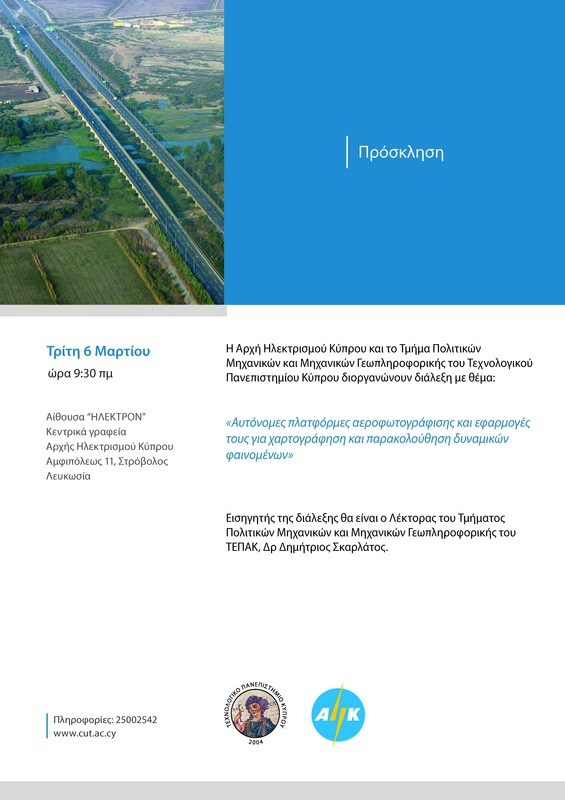
Open lecture in Archaeological Research Unit (ARU) of Cyprus University, will be held at ARU's premices, on Monday 05.05.2014 (invitation pdf)
Technical lecture about UAVs in archaeological site recording at HERICT, Erasmus IP project.
A technical lecture about UAVs and AUAVs in particular has taken place in HERICT IP. It was forwarded in a mixed audience of archaeologists, architects and geomatic engineers. You may downloaded here (in english)
Lecture in Cypriot Assosiation of Rural Surveyors: Modern applications of underwater, close range and UAV photogrammetry.
An invited lecture (November, 2012) regarding recent development in photogrammetric data processing using computer vision techniques has been given. The aim of the lecture was to introduce 'modern' photogrammetry to people familiar only with the tedious photogrammetric processing using manual, semi-automated or even automated processes. Basic description of the new tools provided by the computer vision community and the way they interact within the photogrammetric process has been highlighted.
In order to stress the versatility of the new methodology, applications have been presented regarding underwater, very close range and UAV applications of photogrammetry for detailed 3D modelling, DTM and true orthophoto generation.
You may download the presentation (in greek) here.
In order to stress the versatility of the new methodology, applications have been presented regarding underwater, very close range and UAV applications of photogrammetry for detailed 3D modelling, DTM and true orthophoto generation.
You may download the presentation (in greek) here.
ISPRS Melbourne oral presentation
30 min presentation of the paper COMPARISON OF LASER SCANNING, PHOTOGRAMMETRY AND SFM-MVS PIPELINE APPLIED IN STRUCTURES AND ARTIFICIAL SURFACES, ISPRS Ann. Photogramm. Remote Sens. Spatial Inf. Sci., I-3, 299-304, doi:10.5194/isprsannals-I-3-299-2012, 2012. Download in pdf.
Lectures for modern UAV's abilities and opportunities for mapping applications
As a result of the memorandum of collaboration among CUT and Ministry of interior, a lecture regarding the cartographic abilities of modern UAV's took place in CUT's CEG department to DLS mapping department on Friday 10.02.2012.
A similar open lecture will took place on EAC's facilities on Tuesday 06.03.2012. A demo flight was carried out after the lecture.
You may download the presentation and some photos of the demo flight at 165m height.
A similar open lecture will took place on EAC's facilities on Tuesday 06.03.2012. A demo flight was carried out after the lecture.
You may download the presentation and some photos of the demo flight at 165m height.
Introduction on how are we surveying the trench on a daily basis
... or an answer to "what are these people doing with the cameras underwater and why this is better than traditional techniques?"
Invited lecture in NTUA, titled "Use of Open Source software in cultural heritage documentation"
The lecture was given in 02.12.2011 in greek, but many useful resources
and links are present and can be easily exploited even if "it all sounds
Greek to you"
York Conference
ISPRS working group V/2 conference took place in York during August 2011.
Applications of open and free software: From underwater to the sky.
PRESENTATION with many links to open source software.
Prof. Gordon Petrie highly commented this presentation in Geoinformatics magazine (Oct. 2011).
Applications of open and free software: From underwater to the sky.
PRESENTATION with many links to open source software.
Prof. Gordon Petrie highly commented this presentation in Geoinformatics magazine (Oct. 2011).
What's surveying engineering & geoinformatics ?
A brief, short, and limited presentation (in greek) given to newcomers, to understand the profession and aspects. unfortunataly this presentation has video content that cannot be duplicated in pdf format.
There are examples of lab activities. Unfortunately they do contain video content, than cannot be played in pdf.
A presentation given by the president of Cyprus Association of Rural and Surveying Engineers, during their last years of studies, as a preparation to the profession.
There are examples of lab activities. Unfortunately they do contain video content, than cannot be played in pdf.
A presentation given by the president of Cyprus Association of Rural and Surveying Engineers, during their last years of studies, as a preparation to the profession.
