
Measurements using laser scanning & photogrammetry in documenting an UNESCO monument in Pelendri
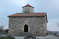
During February 2011, extended field measurements on Pelendri's church took place as part of diploma thesis from Marina Faka & Georgia Bariami, NTUA surveying engineering students. The main task was to fully document the church using complementary techniques, such as photogrammetric survey and laser scanning.
A complete network of pre-signalised targets was measured before laser scanning and photography. Visiting Prof. Andreas Georgopoulos, under sabbatical leave, supervised field measurements and the diploma thesis, while CUT provided supplementary equipment.
Results were presented in EuroMed 2012
A complete network of pre-signalised targets was measured before laser scanning and photography. Visiting Prof. Andreas Georgopoulos, under sabbatical leave, supervised field measurements and the diploma thesis, while CUT provided supplementary equipment.
Results were presented in EuroMed 2012
Software for direct 3D point cloud comparison (2004 & amendments in 2011)
Software development in C++ for 3D model comparison and testing against commercial solutions. Driven by the need to compare the 3D models against different methods, a command line software was developed for direct comparision of 3D pre-aligned point clouds in xyz or ply format (see more). The s/w is available in the d/w page.
Modelling using open David laserscanner (2011)
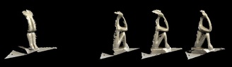
Small object scanning for free, is possible using open source David laserscanner and Meshlab to clean, align and join point clouds.
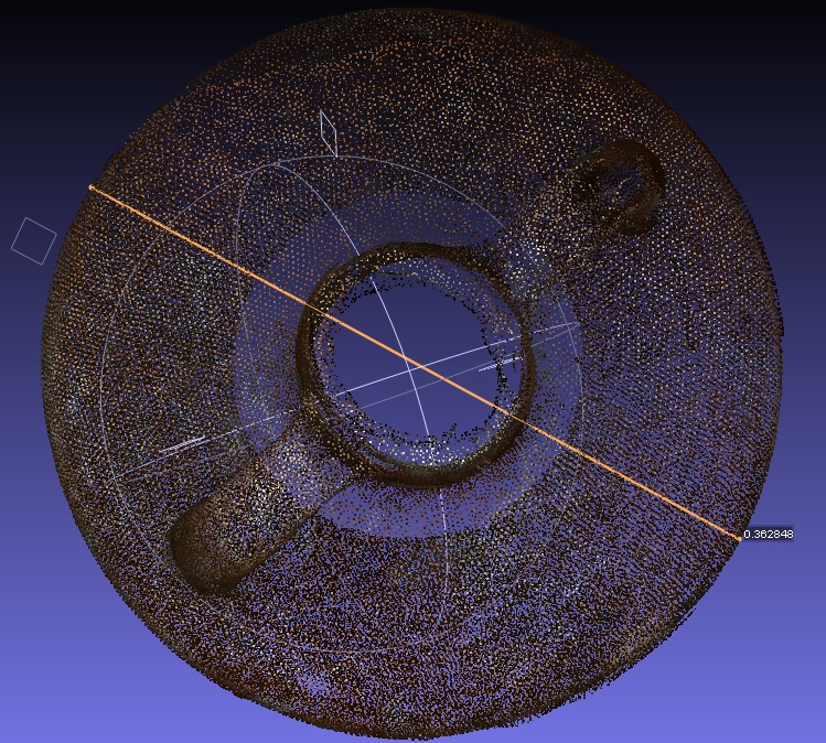
A 12cm statue was used as test object.
A 12cm statue was used as test object.
Modelling using Zscan in Mazotos (2011)
Menci's Zscan is a commercial optical scanner based on trifocal imagery from a known base, to apply scale on the 3D model. It can work in any scale, depending on the bar used.
Results and comparison with similar methods is currently under investigation.
Results and comparison with similar methods is currently under investigation.
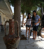
Modelling artefacts using open source software (2010)
A study based on "whether it is feasible to capture precise 3D models using open source software" was succesful. 200K points were captured an modelled using a cheap of-the-self DSLR camera and a "photogrammetric" layout for imagery. Final 3D model is scaled. Test object, an 1m amphora from Mazotos shipwreck.
For more info, see underwater archaeology presentations and publications.
This research was funded by Cyprus University of Technology starting grant "Videometry from mobile platforms"
For more info, see underwater archaeology presentations and publications.
This research was funded by Cyprus University of Technology starting grant "Videometry from mobile platforms"
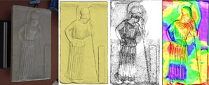
ecoMarble (2000-2002)

At this project a complete 3D 1:1 scale model of a Kouros statue was digitized and created with rapid prototyping techniques. The 3D modelling was done using an innovative (at the time) structured light scanner. More info in the paper the poster or the presentation.
Laser scanning field measurements, in support of STARC, CyI

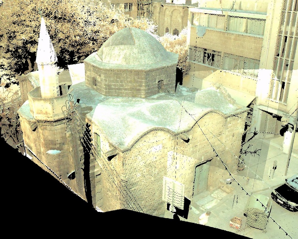
Field measurements with laser scanner have taken place in ancient Idalion and the church of 'Agia Paraskevi' in Nicosia center.
A small part on Idalion was scanned. Laser scanner targets have been measured with total station for georeferencing, while photographs were taken for rendering over the point cloud. Agia Paraskevi was scanned from three stations and data were indented to fill in gaps from a previous scanning session with a different scanner. Data gathered were provided to STARC (Cyprus Institute) for further processing and evaluation. In cooperation with senior researcher Dr. Sorin Hermon (CyI) |
|
