
Developing a photogrammetric monitoring system for dynamic experiments in Earthquake and Large Structures LabPart of the departamental infrastucture, is the aforementioned lab where a strong floor- strong wall is constructed for pseudo-dynamic earthquake experiments of large structures. On it, large structures are being tested under load and the deformations of the skeleton are to be measured. Such measurements are usually being done using velometers able to presicely measure 1D deformations.
By developing a multi image videometry system we will try to measure with sub-milimiter accuracy 3D deformations on presignalized targets of the structure during the experiment excecution. Initially we will try to use three Nikon D90 cameras and Bumblebee X3 machine vision cameras to capture data during the excecution of the experiment and try to post-process them. The final aim is to develop a vesratile videometric system to support such experiments with precise 3D measurements of points or surfaces, using postprocessing techniques. |
|
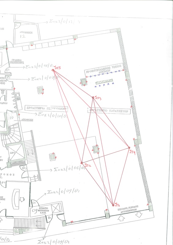
Establishing and measuring a networkThe first step of the project is to establish a local network within the lab. This network is going to be used for evaluating the position of total stations used for multi-resection of control points at the area of the experiment.
For that reason, 25 retroreflective targets were glued within the lab, at approximately 5-6 meters height, so to be out of reach. These targets has been measured from 5 station, using two reflectorless total stations (Leica Flexline TS06plus 1'' and Leica 1203 TPS 3''). Many thanks to Vriona Charlampous, George Christou, Vasilis Kaoullas, Antonis Panagiotou, Konstantina Symeou, who helped voluntarily on the network establishment and measuring. |
|
Camera calibration |
|
