• Home
  • Projects
    • i-MareCulture
    • MOBILO
    • Underwater archaeology
    • Videometry for deformation monitoring
  • Past experience
    • SARCOS [HFF graant]
    • Hawkeye
    • AQUABOT
    • Parthenon's frieze 3D scanning
    • SBA UAV mapping
    • Fourier analysis on MODIS imagery
    • GIS for solar park siting
    • Plant-stress analysis
    • Laser scanning Vs IBM
    • Orthophotos from color point clouds
    • Deformation analysis
    • ARCHEOphoto
    • Real time tile inspection
    • 3D object modelling
    • Mapping with UAV & RF
    • Quicbird NDVI analysis
    • DTM refinment & checking without reference data
  • Publications
  • People
    • D. Skarlatos
    • Partners
    • Staff
    • Main Collaborators
    • Job openings
  • Equipment
    • Lab h/w & s/w
    • UAVs
    • Videos for >
      • Aerial Cameras for mapping
      • Cameras film & digital
      • UAVs
      • Terrestrial Laser scanning
      • Alternative scanning solutions
      • Small and medium object scanning
      • CUT's optical scanner
      • CUT's terrestrial laser scanner
      • Lab's UAVs
      • Mix of Interesting Videos
  • Courses
    • Presentations
    • News about courses
    • External links
  • Software
  • News
Photogrammetric Vision Lab
Cyprus University of Technology
​Civil Engineering & Geomatics Dept.

MOBILO

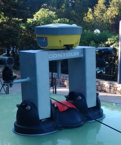
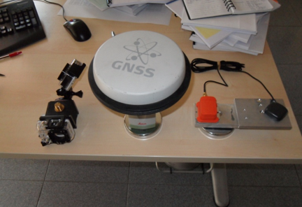
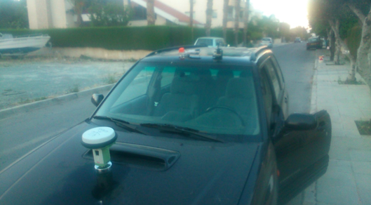
Mobilo stands for "Smart Mobile Acquisition Toolbox for Infrastructure Data Recording and Monitoring", a research and development program implemented in Cyprus that combines several parts such as low cost GNSS RTK, INS / IMU boards and machine vision cameras, into one low cost mobile mapping system that allows measurement digitizing and analyzing of survey field data

Mobilo is funded by Cyprus Reasearch Promotion Fundations's "Enterprises" program

For more information, please follow the link
Picture

Powered by Create your own unique website with customizable templates.